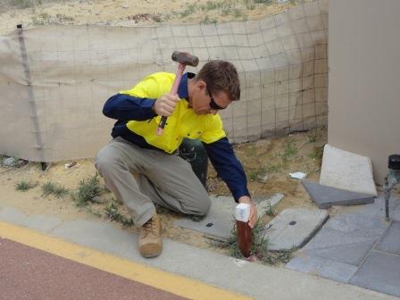
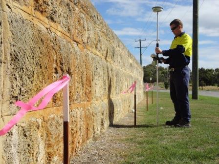
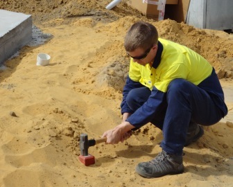
Boundary Repeg and Identification
When a large parcel of land is subdivided into smaller parcels called lots, the new boundary corners of these lots have to be marked with wooden survey pegs by a Licensed Surveyor. As improvements such as fencing and brick walls are constructed over these new boundary lines, the pegs are gradually disturbed over time and in most cases are removed or destroyed by the development. To correctly position a new fence or structure on or near a property boundary you should contact Pro West Surveying to repeg or identify the original boundary corners . If you are concerned about the position of existing structures along the property boundary, a Boundary Identification survey will help to clearly identify these structures in relation to property boundary.

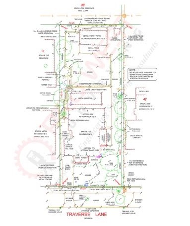
Feature and Contour Surveys
This type of survey involves measuring all the buildings, structures, fences, improvements and services on a block of land and producing an accurate survey plan with levels and contours . The surveyor will place a datum nail in a suitable position such as the road bitumen and this will provide a reference point for which all heights on the survey plan can be referred to. If you are building / extending a new home or commercial building, constructing boundary walls or subdividing a property, a feature survey will be required as part of the design process . A feature survey plan is an important tool used by builders, designers, architects and developers and will usually be an initial requirement to obtain a building development approval or building license. Please contact Pro West Surveying for all your Feature and Contour Survey requirements.
© Copyright 2013 by Pro West Surveying . All rights reserved
Branding & Web Design by Perth Logos