
Q1: Can I subdivide my land?
The subdivision potential of your land is firstly governed by the R-Codes "See answer to Q5 below". Other factors to consider include whether you plan to retain any existing dwellings, existing easements / restrictive covenants that may affect future building and the availability of utility services for the proposed new lots. If your land is part of a strata scheme you may also need to gain consent from the strata company before subdividing. If you would like Pro West Surveying to make initial enquiries about the subdivision potential of your property we would be happy to help. We will do this free of charge and you will not be obliged to continue the subdivision process with us.
Q2: I have been told that my property has subdivision potential. What is the best type of subdivision to do?
There are many factors to consider when subdividing your property. Your choice of subdivision will firstly be governed by the R-Codes, which set minimum site requirements for each type of subdivision. These minimum requirements include lot area, lot frontage and building setbacks to the new lot boundaries. Other factors to consider are whether you wish to retain an existing dwelling or the position of available utility services to the proposed new lots.
Q3: What suburbs do Pro West Surveying perform subdivisions in?
Pro West Surveying perform subdivisions statewide from Broome to Esperence. Our surveyors have extensive subdivision experience in the following suburbs: Armadale, Balga, Balcatta, Bassendean, Bayswater, Bedford, Belmont, Dianella, East Cannington, East Victoria Park, Ferndale, Highgate, Leederville, Karrinyup, Kewdale, Morley, Nollamara, Mount Hawthorn, Mount Lawley, North Beach, North Perth, Osborne Park, Riverton, Roleystone, Rockingham, Shelley, South Perth, Tuart Hill, West Leederville, Wanneroo, Westminster, Wilson and Yokine.
Q4: What is the difference between a Strata Subdivision and a Freehold Subdivision?
To learn more about Strata Subdivision please refer to the following link.
To learn more about Freehold Subdivision please refer to the following link.
Q5: What are R-Codes and how do they affect my land?
The term R-Codes is an abbreviation for Residential Design Codes of Western Australia, which have been prepared by the Western Australian Planning Commission. These codes provide the basis for controlling the design and minimum site requirements for land developments across WA. Generally low R-Code numbers relate to low density developments such as rural suburbs , whereas high R-Code numbers relate to high density developments such as inner city suburbs. To assess the subdivision potential of a property the first step is to find out the R-Code. This information can be obtained by speaking to the planning department of your local shire or council. If you would like more information on R-Codes or a copy of the latest R-Codes Table please contact Pro West Surveying.
Q6: When referring to a Strata Title Scheme what does Unit Entitlement mean?
The Unit Entitlement will be shown of the strata plan and shows the relative proportion of each owner's share of the scheme. The unit entitlement is determined by a Licensed Valuer and is calculated to take into account the capital value of buildings on the strata lots as well as the land. The value of the unit entitlement governs your proportional obligation to pay levies and your voting rights within the strata scheme.
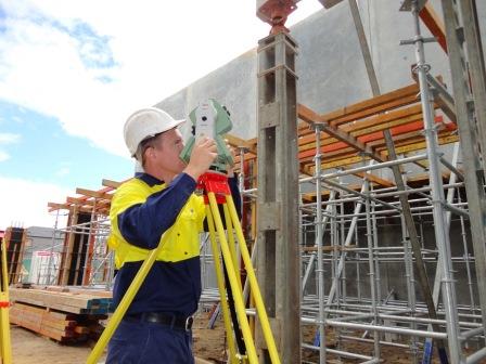
Q7: I am planning on building a new home and my architect has asked me to order a survey of the development lot. What type of survey do I need?
The first type of survey you will need is a feature / contour survey. The feature survey will show all the existing levels on the development lot, the perimeter fencing, kerbs, paths, easements, existing buildings and utility services. The architect or designer will require all of this information in order to design the elevation of the new home and to tie into any existing structures and services on the property.
Q8: I am building a new brick wall along the front boundary of my property and my local council has advised that I should have the boundaries surveyed by a Licensed Surveyor. What type of survey do I need?
If you are building the brick wall on or near your property boundary you will require a repeg or boundary definition survey. The Licensed Surveyor will place boundary pegs or marks at the boundary corners of the property. If required, pegs can also be placed along the boundary line near the location of the wall. The boundary marks should be used as a guide to ensure that the brick wall is built inside the boundaries of your property.
Q9: My neighbour has told me that our dividing fence is encroaching into their property by 1 metre. They have asked if we may remove the fence and place a new one in the correct boundary position. What course of action should I take?
If your neighbour has not already done so you should employ the services of a Licensed Surveyor to perform a Boundary Identification Survey along the dividing fence. A Boundary Identification Survey will help to identify the position of the fence in relation to the property boundary and may prevent any further action being taken by your neighbour. If the fence location is found to be in error then Pro West Surveying can help to advise you of the further options available.
© Copyright 2013 by Pro West Surveying . All rights reserved
Branding & Web Design by Perth Logos